


At a glance
- Estuary cities have different climate change challenges to delta cities, as they need accommodate river and sea influences.
- Putting water at the centre is a new approach to design of estuary cities with the idea to improve ecological balance while promoting wellbeing and cultural values.
- Researchers investigated challenges and opportunities in urban estuaries where spatial, urban and environmental shifts are exacerbated by climate change, ecological disturbances and population growth.
- Using case studies of the cities of Perth and Newcastle – two different bioregions and urban estuaries – researchers created site-specific design strategies to operate in low to medium-density precincts, leveraging water and nature as design tools to improve urban resilience and liveability.
- Research outputs include replicable tools, with strategies, design research and design educational methods applicable to other estuary cities.
Estuary cities under threat
Estuary ecosystems are fragile, complex and highly dynamic systems. They are on the front line of climate vulnerability and are essential as city mitigation and adaptation assets.
Unlike deltas where rivers reach into the sea, estuaries allow the sea to ‘come in’. They are subject to both tidal and riverine influences, where saline and fresh waters meet, bringing significant rates of seasonal flux and high levels of biodiversity. Estuary cities require the water to be ‘accommodated’ rather than ‘fought’.
Research by Irene Lopez at University of Newcastle and Daniel Martin at University of Western Australia investigated the challenges and opportunities presented by climate change, ecological disturbances and population growth to rethink Australian estuary urbanism. The researchers selected two estuarine cities as case studies: Perth, Western Australia; and Newcastle, New South Wales.
In Perth, a city of wetlands, urbanisation has resulted in filling in of wetlands and areas of biodiverse, ancient vegetation to construct sprawling suburbs.
While in Newcastle, the coastal and riverine environments are under increased threat from flooding and drought, rising sea levels, erosion and contamination. These pressures require a swift transition into new ways of doing urbanism and planning in harmony with living systems.
Estuary cities require the water to be ‘accommodated’ rather than ‘fought’.
A tale of two cities
Urban development poses an ongoing threat to the waters, biodiversity and resilience in both cities, especially in the context of drying and warming climate trends. Despite rapid and substantial changes and extensive land clearing, Perth remains a rich and megadiverse ecosystem, where biodiversity is in conflict with human impacts. At least 70% of Perth’s wetlands have been filled since European settlement, erasing the historic wetlands of the Swan coastal plain. Since then the Swan-Canning (Bilya) estuary has transformed into a predominantly saline system, particularly in recent decades as rainfall and streamflow have declined.
In the NSW Hunter estuary, mining, farming and grazing have transformed the region, resulting in more than 85% of the native vegetation lost, only 40% of forested areas retained and 99% of riparian vegetation removed from the river and its tributaries.
Design research in estuaries requires considering the constant presence of water, the study of its patterns and flows in multiple scales and the development of strategies able to adapt to its cycles, both long and short.
Treating water as the “ground of settlement” gives rise to new design opportunities in the terrain of water. Making water and natural systems and their dynamics visible in the urban context reconnects people and nature, fostering more resilient and sensitive communities. In Perth and Newcastle – where land reclamation and fill systematically erase water and modify water systems – business as usual development dominates the landscape.
Treating water as the “ground of settlement” gives rise to new design opportunities.
Treating water as the “ground of settlement” gives rise to new design opportunities in the terrain of water. Making water and natural systems and their dynamics visible in the urban context reconnects people and nature, fostering more resilient and sensitive communities. In Perth and Newcastle – where land reclamation and fill systematically erase water and modify water systems – business as usual development dominates the landscape.
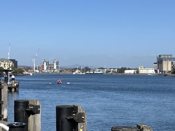
It's complicated! Many Australian cities are located on estuaries and any adaptation planning will need to consider influences of both river and sea
- © NCCARFIMG_5668

It's complicated! Many Australian cities are located on estuaries and any adaptation planning will need to consider influences of both river and sea
© NCCARF
A new approach to urban design in estuaries
The researchers have established design methods and principles that can inform future practices, leveraging water as a design tool to improve urban resilience. Taking a full ecosystem approach, they considered paths of ancient water systems, the present spaces under threat and sites of opportunity for a new landscape of water to rethink estuary urbanism, given projections of a changing climate and growing population.
The research incorporates cartographic and data analysis and visualisation. Mapping reveals cultural and environmental patterns and maps represent dynamic systems in multiple scales over time. For both cities they used a significant amount of geospatial data with GIS software (ArcGIS, QGIS) and then represented it with graphics software (AutoCAD, Rhinoceros, Adobe Suite) or hand sketching, photography and modelmaking.
‘Place Value Ashfield’ considers infill
As part of the project, the University of Western Australia School of Design conducted a project to demonstrate a landscape-led approach to infill housing aligned with living systems in the Perth suburb of Ashfield. A proposed densification of Ashfield has been proposed for more than a decade. The project, ‘Place Value Ashfield’ focused on how infill can support rather than diminish the landscape, to strengthen the suburb’s ecological and civic realms. They adopted a landscape-led approach involving coordination and collaboration between architects, landscape architects, developers, government authorities, stakeholders and the community, including Traditional Owners.
Central to the framework was the need to respect the vitality of the Ashfield Flats wetland system and the suburb’s surface and sub-surface water flows. The Flats include sedge lands, riverine bushland, and a nationally protected ecological community of saltmarsh. Future densification in the catchment poses a significant threat to the Ashfield Flats. Declining tree canopy and increasing urban heat alongside the flats threaten biodiversity linkages and ecologies. An increase in impervious surfaces threatens to alter fragile water flows to the aquifer, which sustains the flats.
The strategy took the form of new landscape corridors through Ashfield to support sensitive types of infill housing to facilitate density while supporting and strengthening living systems. Connecting to existing blue and green networks is a crucial aspect, which addresses the regional catchment context. The diverse urban forest and vegetation matrix is bolstered throughout backyards, verges and public open spaces. By reducing urban footprints and prioritising lightweight construction methods, the Ashfield housing schemes retain existing trees and the permeability of the ground, maintaining flows to the aquifer.
The strategy promotes housing diversity by encouraging a range of densities across the suburb. Each housing scheme is integrated within the broader landscape framework, with features such as retention of and increases to tree canopy, improved pedestrian and cycling connections, permeable and water-sensitive private and public open spaces and new landscape-sensitive construction techniques.
City-scale to precinct scale thinking: Corrumbah-Carrington
In Newcastle, three urban and environmental features characterise the Coquun-Hunter Estuary: the floodplains, the riverine waterfront, and the coastline. The floodplains where the city sits are dominated by urbanisation and industrial activities linked to the mining sector, heavy industry and port facilities.
Since European settlement, the estuary has suffered an ecologically devastating land reclamation and infill process, including systematic erasure of water bodies. From an area of tidal islands fringed with mangroves and dense vegetation of banksia, honeysuckle, tea trees and swamp oaks, which was only accessible by boat, it is being progressively infilled by ballast and dumping of industrial waste. Land is being reclaimed along the riverine waterfront, transforming the ‘terrain of water’ into land for industrial activities, which is transitioning into residential, commercial and leisure uses.
Creating a ‘blue-green buffer’ in Corrumbah-Carrington
The suburb of Corrumbah-Carrington is located on the estuary. Like the rest of the river frontage, it has been drastically modified. Substantial dredging has transformed tidal islands into the Port of Newcastle, the largest harbour on the east coast and the world’s largest coal port. Corrumbah-Carrington sits in the terrain of water despite the land reclamation and infill. Hard edges have replaced natural levees with the construction of channels and flood levees that have deprived the river of new layers of alluvial soil and eradicated riparian vegetation. Sea level rise projections show that 80% of Corrumbah-Carrington will be permanently below sea level by 2100.
Adaptation in Corrumbah-Carrington requires a multiple-action approach, including responses to weather variability to cope with alternating dry and wet periods; transition into a climate-resilient suburb model through new approaches to habitation and infrastructure; improvement of water performance in the built environment; and restoration and expansion of riverine ecological corridors.
The landscape strategy takes the form of a ‘blue-green’ buffer – forming corridors connecting Carrington with Throsby Creek and beyond. The scale of this public space buffer creates opportunities to construct green embankments and levees, terraced floodable wetlands and floodable parks planted with mangroves. Strategies to improve infiltration include replacing impervious surfaces with permeable paving materials, improving topsoil quality, installing infiltration trenches and urban revegetation with native shrubs and trees.
Measures to improve infiltration and runoff capacity – such as bioswales, street channels and open drainage – integrate stormwater treatment into the urban landscape, while increasing safety by reducing runoff and peak flow in intense rain periods. ‘Water plazas’ can act as public space and sport areas during dry periods and water storages in wet seasons.
At the dwelling scale, the architecture integrates water servicing technologies to minimize demand, promote a decentralised urban water system and harvest stormwater for reuse.
Urban planning for climate resilience
The two case studies highlight the urban-biodiversity conflict, but also the opportunities for resolution and resilience in a changing climate. In two places where ongoing urban development and densification are projected to conflict with the environment, the project has tested and highlighted future ‘resilience by design’ to the community and policymakers.
It was important to use both descriptive and projective methods in the project to demonstrate how ecological design strategies can be incorporated into future practices and design guidelines to impact wider urban areas.
In both case studies, the design research methods and ‘water-wise’ design strategies show the usefulness of working across scales – from bioregion, catchment, urban, precinct and plot – to understand historical ecology and hydrology. Adaptation measures involve long planning horizons, long-term significant investments and consensus.
of the project successfully created site-specific design strategies that provide insight into how to operate in low to medium-density precincts to make them part of larger ecosystems and hydrological catchments, improving urban sustainability and resilience. Future research will test design strategies by modelling and simulating flooding scenarios using physical and computational hydrodynamic models.
To cite:
This case study was prepared by Irene Peres-Lopez and Daniel Martin. Please cite as: Perez Lopez, I and DJ Martin, 2024: Rethinking estuary urbanism – preparing Australian estuarine cities for climate change. Case study for CoastAdapt, National Climate Change Adaptation Research Facility, Gold Coast.
Further information
- Perez Lopez, I. and D.J. Martin 2023: Rethinking estuary urbanism– Preparing Australian estuary cities for changes to come in the climate and biodiversity emergency. Sustainability 15, 962. article (Open access, so free to view)
- Cooperative Research Centre for Water Sensitive Cities:
- Water by Design takes a broad look at sustainable water and urban design