


At a glance
- Coastal adaptation in Australia increasingly uses a pathways approach, where locally defined flood‑impact thresholds (e.g., a main street flooding more than five days per year) trigger staged adaptation actions.
- A new extreme sea level frequency dataset, developed by Bureau of Meteorology researchers, shows how rising mean sea levels increase the frequency of extreme sea level events at 37 sites nationwide.
- By combining this dataset with local flood thresholds and sea‑level rise projections, councils can now better estimate when key flooding triggers will be reached and plan adaptation measures in advance.
Dataset and framework supports a pathways approach
To manage the changing risks associated with increasingly frequent coastal flooding due to sea level rise, coastal management in Australia has increasingly adopted a pathways approach to climate adaptation planning. These plans are based on the identification of locally relevant thresholds that trigger the phased implementation of adaptation measures to increased coastal flooding. Such thresholds are typically based on the changing frequency of locally defined flooding impacts – for example, a coastal town’s main street being inundated for more than five days in a year.
To enable effective pathways planning, requires projections of the changing frequency of extreme sea levels around Australia, giving coastal managers vital information about when each threshold may be reached and how much time they may have to implement adaptation measures. A study lead by Australia’s Bureau of Meteorology researchers has now filled this data gap.
The team used recent tide gauge data to quantify how mean sea level rise increases the frequency of extreme sea levels at the local scale. The dataset estimates changes in frequencies of present-day extremes at 37 locations around Australia.
At the local scale, the sea level at which a specific flood event occurs – such as flooding of the main street – can be established based on historic data of past flood events. By combining the new extreme sea level frequency data with existing data projecting the timing of sea level rise around Australia, councils can now predict when key flood event frequency thresholds are likely to be reached.
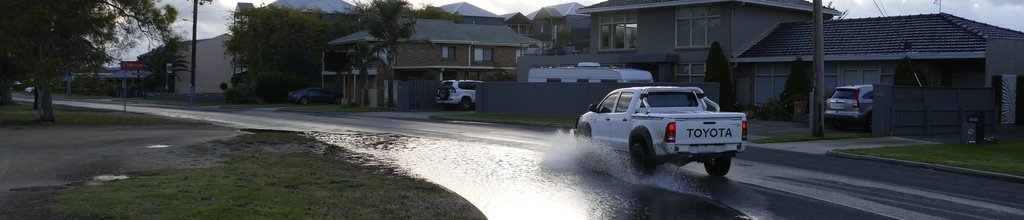
A worked example: Lakes Entrance, Victoria
In the study, the researchers used the low-lying settlement of Lakes Entrance, Victoria, as a worked example, considering existing adaptation triggers established through community consultation and planning benchmarks set by the Victorian Government.
They showed that the town currently has approximately 50 years to prepare future actions while adapting to increasingly frequent and severe high tide flooding. It then has at least another 30 years to implement a full-scale managed retreat of the town before the onset of further adaptation triggers.

Inundation along the Esplanade east of Myer St in Lakes Entrance
- @ Photographer Rodger Grayson, from Hague et al. 2024Esplanade E of MyerSt_1_0629_151121

Inundation along the Esplanade east of Myer St in Lakes Entrance
@ Photographer Rodger Grayson, from Hague et al. 2024
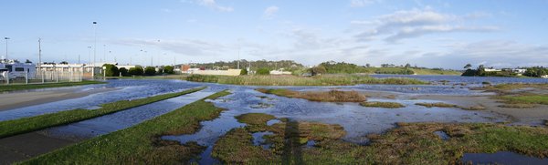
Inundation around the Lakes Entrance Bowls Club
- @ Photographer Rodger Grayson, from Hague et al. 2024LEBowls club_2_0635_151121

Inundation around the Lakes Entrance Bowls Club
@ Photographer Rodger Grayson, from Hague et al. 2024
Using the dataset
the dataset, which can be accessed in the supplementary material of the research paper reporting the study, at https://www.publish.csiro.au/es/acc/ES23024/ES23024_AC.zip
a webinar by Bureau of Meteorology where Ben Hague describes the rationale and methods used in the paper that can help you plan for key flood events for your location.
It is very useful to watch the entire webinar because it puts the dataset in context, but if you are wanting to see just how the data set is used, you can jump to around 27 minutes.
The dataset has other potential applications beyond long-term climate adaptation planning. It can enable an impact-based assessment of forecast storm surge events, supporting the issuing of severe weather warnings in conjunction with the emergency services.
The dataset also enabled a national assessment of the potential for chronic flooding around Australia. The assessment showed that 85% of Australian locations can expect today’s 1-in-100-year extreme floods to occur at a frequency of 30 days a year with less than 1 metre of sea level rise. This sea level rise is projected to occur before 2100.
To cite:
This case study was prepared by NCCARF. Please cite as: NCCARF, 2024: Dataset of future coastal flooding frequency enables location-specific planning for sea level rise. Case study for CoastAdapt, National Climate Change Adaptation Research Facility, Griffith University, Gold Coast.