


At a glance
- Coastal decision-makers are increasingly adopting a pathways approach to coastal adaptation, using locally defined flood‑impact thresholds to trigger staged responses as sea‑level rise increases coastal flooding.
- Bureau of Meteorology research provides extreme sea‑level frequency data for 37 Australian locations, showing how rising mean sea levels make coastal flood events occur more often.
- By combining this dataset with local flood thresholds and sea‑level rise projections, councils can now better predict when flooding triggers will be reached and plan adaptation measures in time.
Tidal flooding to become more frequent
Urban centres around Australia’s coastline are typically located on estuaries. Today, estuarine flooding tends to occur during extreme weather events, particularly when high precipitation and storm surges coincide to produce simultaneous high riverine water flows and high sea levels.
In coming decades, an alternate form of coastal inundation will become increasingly common due to sea level rise. Tidal flooding, where water levels exceed flood thresholds at high tides even under benign weather conditions, will become the predominant form of estuarine flooding, shows a systematic new Australian analysis.
The Bureau-led study considered a metric called freeboard, which is the difference in water level between a high tide and a flood threshold. Current location-specific freeboards can be readily calculated: the highest astronomical tide (HAT) can be taken from tidal gauge data, and thresholds for minor, moderate and major flooding can be established from the water level during past flood events, or from official flood levels.
For example, a location with a HAT of 2.2 m, and a minor flooding threshold of 2.6 m, has a ‘minor HAT freeboard’ of 0.4 m. At such a location, the threshold for minor flooding is currently 0.4 m higher than the highest astronomical tide. This location would expect the onset of minor tidal flooding once it has reached 0.4 m of sea level rise, as this would increase the high tide level by 0.4 m.
Further location-specific tidal flooding insights can be gained by calculating the freeboard for annual average highest astronomical tide (AHAT), or the monthly average highest astronomical tide (MHAT) from tidal gauge data. A location with a medium MHAT freeboard of 0.6 m can expect approximately monthly medium-level flooding once sea levels rise by 0.6 m.
The researchers calculated freeboards at 75 estuarine tidal gauge locations along Australia’s east coast. Of these locations, 30 had a minor HAT freeboard of less than 0.7 m, and 11 had a minor HAT freeboard of less than 0.2 m.
Another key finding was that there was a very small difference between the HAT, AHAT and MHAT freeboards: less than 0.2 m. Therefore, a location can go from experiencing its first tidal flood, to experiencing chronic tidal flooding, with 0.2 m of additional sea level rise – a rise that is projected to take less than two decades.
Of the 75 estuarine locations considered in the study, the places highlighted as most at risk of tidal flooding onset were different to the locations that typically experience extreme weather event flooding today. Locations just inside the mouth of the estuary were found to be most at risk of future tidal flooding.
Decision-makers can make their own calculations using the guidance in the paper Hague et al. 2024 (see source material below)
Rules of thumb for potential future shift to a change in flood risk
As a general guide, the researchers identified the following characteristics could be significant (noting that a location should have its own detailed assessment).
- Locations with smaller tidal ranges and lower freeboards may be at risk of a transition in flood regime
- Locations immediately inside the mouth of a tidal river or lake may be at risk of a transition in flood regime. (The researchers noted that many of these locations did not yet have official flood thresholds, which are a measure of relative vulnerability of the community and its built assets to flood hazard and is used to understand and manage flood risk)
- Counterintuitively, locations already most at risk of flooding due to storm surge and riverine influences, are not necessarily most at risk of future chronic tidal flooding: that is, present day compound flood risk may not be a reliable predictor of future compound flood risk.
An example in the Northern Rivers region, NSW
One such location is the town of Ballina, New South Wales, located at the mouth of the Richmond River. Although Ballina has no officially defined flood threshold, in their research paper the researchers showed how a flood threshold, and therefore a freeboard, could be calculated from water level gauge data of past flood events: specifically the nuisance tide-driven flooding during January 2014 king tides and the 4 March 2022 compound flood event when high streamflow coincided with high tides. The analysis showed that, by late century, Ballina could transition from nuisance tidal flooding to very damaging tidal floods under projected sea level rise of approximately 0.7 m.
The study suggests that by late century, several locations including Ballina could transition from nuisance tidal flooding to very damaging tidal floods
- © Wendy KingIMG_3512

The study suggests that by late century, several locations including Ballina could transition from nuisance tidal flooding to very damaging tidal floods
© Wendy King
'Nuisance flooding' can be more than annoying
Frequent low level of inundation is often referred to as 'nuisance flooding' because it disrupts routine daily activities but seldom threatens public safety or causes major property damage.
This term can irritate communities that are dealing with its impacts such as flooded footpaths, road closures, minor property damage. The impacts of nuisance flooding can accumulate over time to strain infrastructure (especially footpath, road and stormwater systems), reduce property prices and increase rusting of vehicles.
Nuisance flooding is also known as sunny day flooding.

So-called 'nuisance flooding' causes community fatigue: and yet could become more common in some estuary towns and cities.
- © Wendy KingIMG_3507
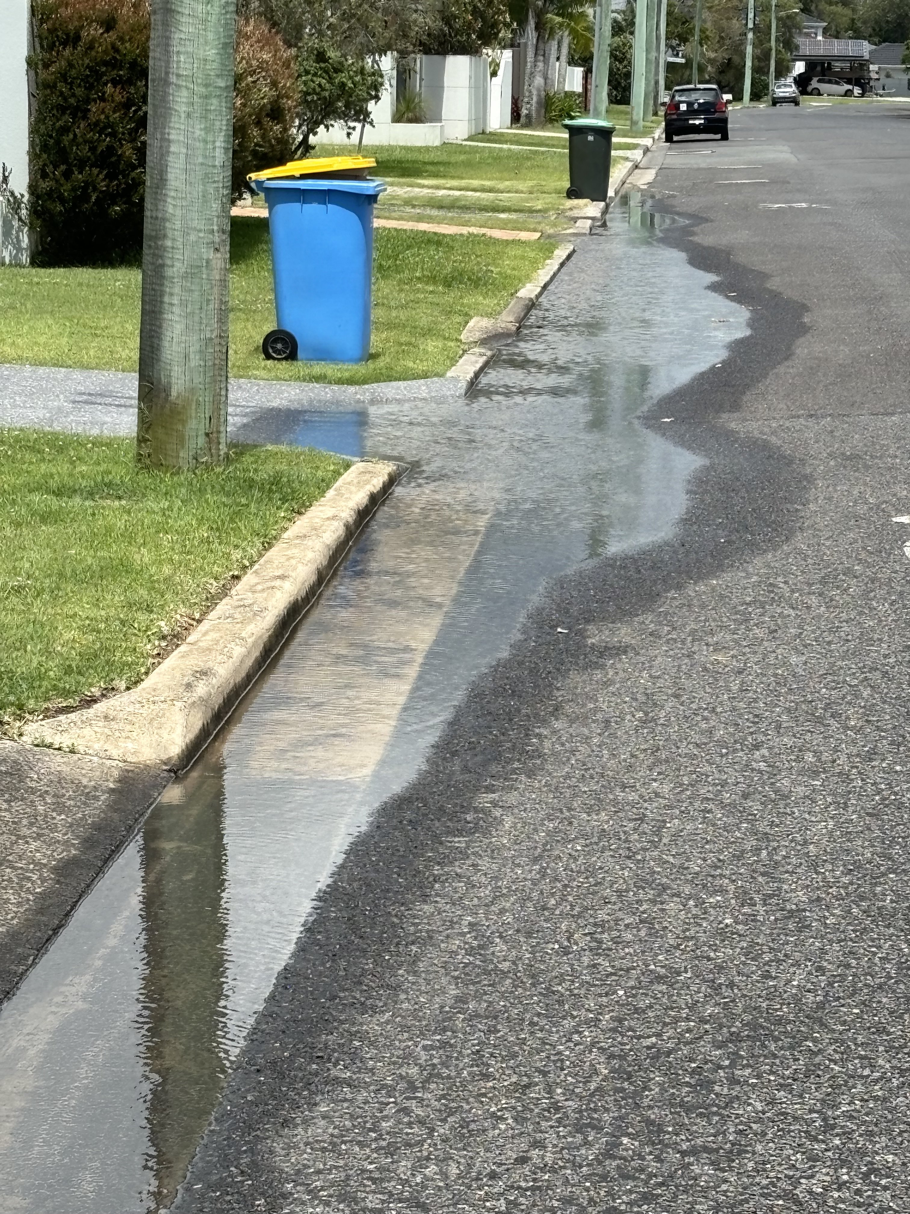
So-called 'nuisance flooding' causes community fatigue: and yet could become more common in some estuary towns and cities.
© Wendy King
To cite
This case study was prepared by NCCARF. Please cite as: NCCARF, 2024: Identifying eastern Australian estuaries that may become future tidal-dominated flooding hotspots. Case study for CoastAdapt, National Climate Change Adaptation Research Facility, Griffith University, Gold Coast.