


Our site has undergone a major design upgrade, with content updates continuing over the next few months. As a result, some pages may have changed location. If you can’t find what you’re looking for, please use the search function or contact us for assistance.
Comments, questions, content? Email: CoastAdapt@griffith.edu.au

Refreshed, rewritten, relaunched. CoastAdapt's 2025 edition.
You are now reading the refreshed version of CoastAdapt, published in 2025.
From 2023-2025, CoastAdapt has undergone a major redevelopment to reflect advances in coastal science, climate projections, and adaptation practice since its initial release in 2017.
This updated version builds on the strong foundation established by the original platform while improving accessibility, usability, and relevance for today’s coastal managers and communities.
The new CoastAdapt features updated scientific data, including the latest sea-level rise and coastal hazard information (from AR6), along with refreshed guidance, tools, data and case studies that illustrate good pra
About CoastAdapt
Through working with practitioners, scientists, policy makers and communities, CoastAdapt remains a unique resource for strengthening coastal adaptation across Australia.
The refreshed CoastAdapt features updated scientific data, including the latest sea-level rise and coastal hazard information (from AR6), along with refreshed guidance, tools, data and case studies that illustrate good practice (or lessons learned the hard way) in adaptation planning.
Even with considerable advances in climate adaptation and coastal planning in many states, CoastAdapt continues to play an essential national role. It provides a consistent, science-based knowledge base that supports alignment across jurisdictions; practical tools and case studies that help translate policy into local action; and a dynamic platform for sharing new research, data, and lessons learned.
The redevelopment process involved collaboration between NCCARF, coastal scientists, planners, and local government users to ensure the content meets current decision-making needs.
Explore CoastAdapt - and send us feedback
We invite you to explore CoastAdapt – we are sure you will find something useful. We welcome feedback on CoastAdapt: from small tweaks through to big new ideas! There is a feedback tab on the right hand margin of every page. If you want to email a more detailed query, please use coastadapt@griffith.edu.au.
Providing something relevant and useful for different users
To meet the needs of a wide and varied audience, CoastAdapt presents information at different levels, from concise overviews to detailed technical explanations.
This approach recognises that users engage with material in different ways depending on their roles, interests, and available time. By layering information in this way, CoastAdapt ensures accessibility for all users, from those seeking quick insights to those undertaking in-depth research or planning.
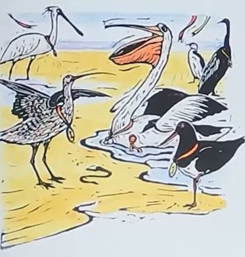
Our approach to providing different levels of information was inspired by shorebirds. We use the feeding strategies of coastal birds as a metaphor for how readers interact with information: some birds feed by skimming the surface, while others take a deeper dive.
- @ Narelle Oliver 1993. The Best Beak in Boonooroo Bay.best beak in boonooroo Bay

Our approach to providing different levels of information was inspired by shorebirds. We use the feeding strategies of coastal birds as a metaphor for how readers interact with information: some birds feed by skimming the surface, while others take a deeper dive.
@ Narelle Oliver 1993. The Best Beak in Boonooroo Bay.
more about CoastAdapt's approach to information: Are you a skimmer, wader or diver?
Note, you may be all three at different times or for different topics!
CoastAdapt's new banner
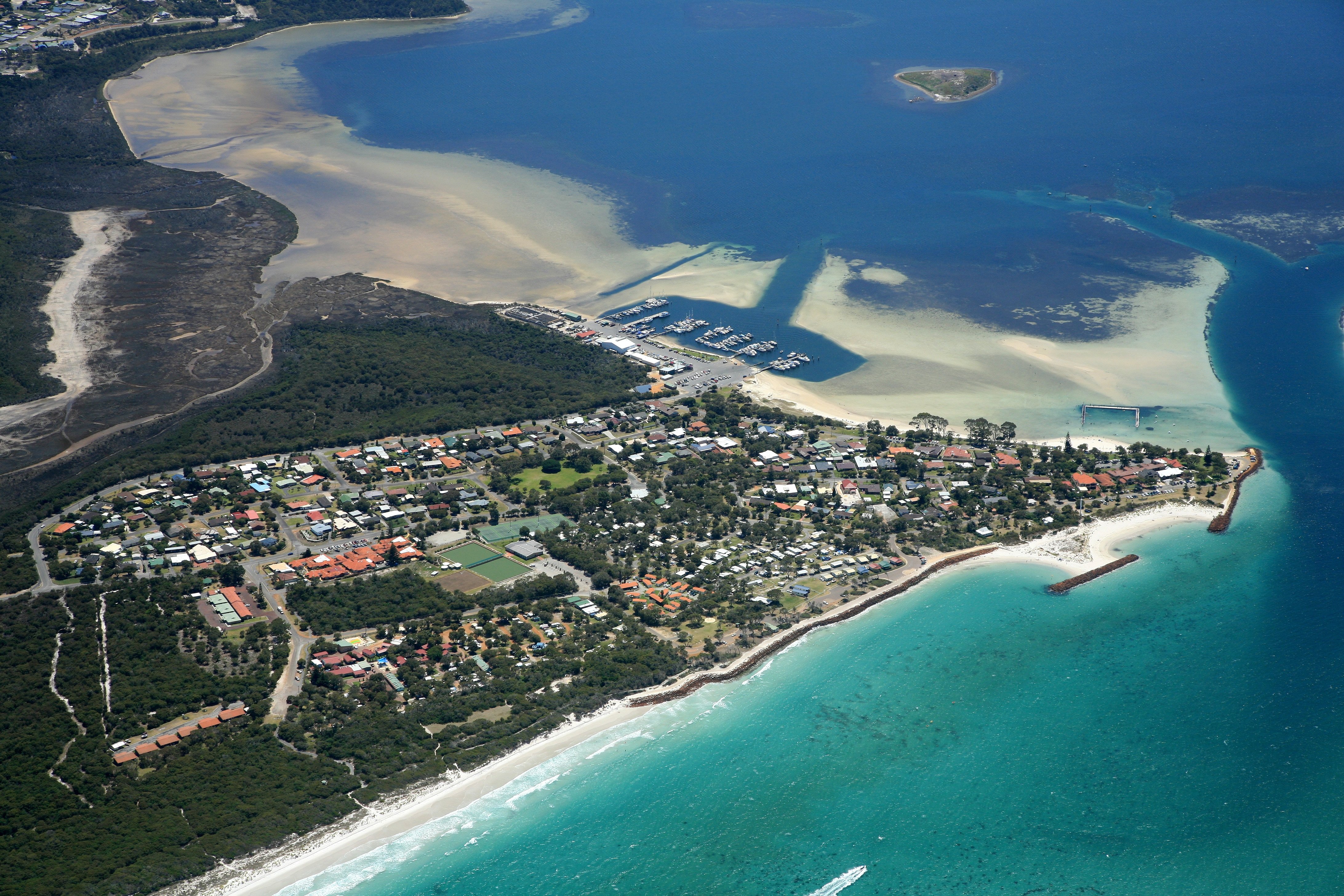
CoastAdapt has a new banner image!
The new banner features an image from Albany – Minang Country – in Western Australia, chosen to illustrate the complexity of coastal adaptation. It highlights the long-term planning and implementation required for managing sandy beach environments.
This image exemplifies the layered and adaptive nature of coastal management over time.
It captures a diverse and evolving coastal landscape, including: a harbour with boat pens, marine servicing facilities, and a boat ramp; Oyster Harbour and its surrounding bay; training walls and an offshore breakwater that has transformed into a tombolo; seawalls of various styles and generations – a promenade-style seawall within the harbour, and rock seawalls outside the bay, each extension at the previous terminal scour; a buried seawall at the opposite end of the beach; sandbag groyne trial in disrepair. More recently, an artificial reef has been opened in July 2025, designed to enhance surf conditions
We thank the City of Albany for permission to use this image, and we are especially grateful to Anna Kelderman from Shape Urban (WA) for recommending it as emblematic of the challenges and opportunities in coastal adaptation. Photographer is Matt Van Nieuwkerk.

Albany EM CoA 1
© City of Albany
The earlier version of CoastAdapt 2014-2017
This current version of CoastAdapt builds on an intensive period of consultation and development by National Climate Change Research facility (NCCARF).
In 2014, NCCARF was commissioned by the Australian Government to build a coastal climate risk management tool that, according to the Funding Agreement, should:
- be national in scope, but recognise variations in climate, and regulatory and planning systems
- be appropriate for new developments and areas where substantial assets are already at some risk from coastal climate hazards
- provide users with access to the best available science and advice on coastal climate risks and regional sea-level rise projections
- incorporate the views of end users, regarding its design, content, delivery and dissemination
- be communicated in plain English
- be illustrated with practical case studies.
In summary, to produce a tool to support coastal decision-makers and managers in Australia, especially but not exclusively in local councils, to understand their risks from climate change and sea-level rise, and to take action to address those risks.
Launched as CoastAdapt in 2017, the scope and contents of the decision support platform or 'tool' had evolved in response to suggestions and comments from potential users during an extensive consultation process.